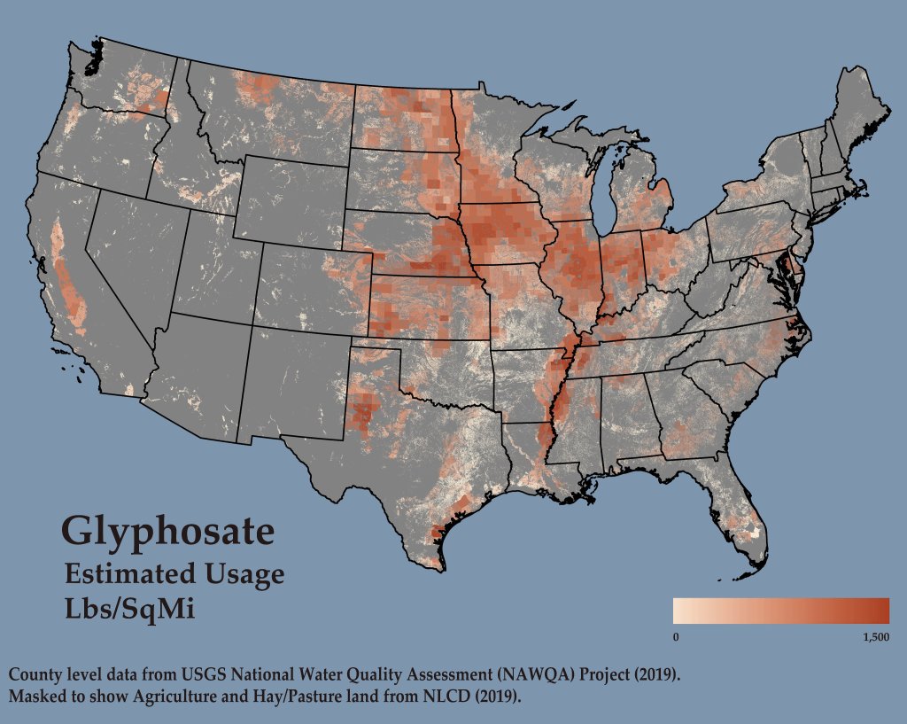
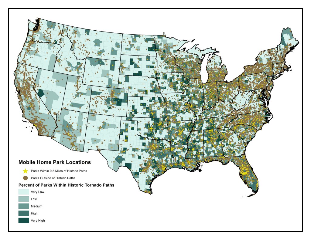
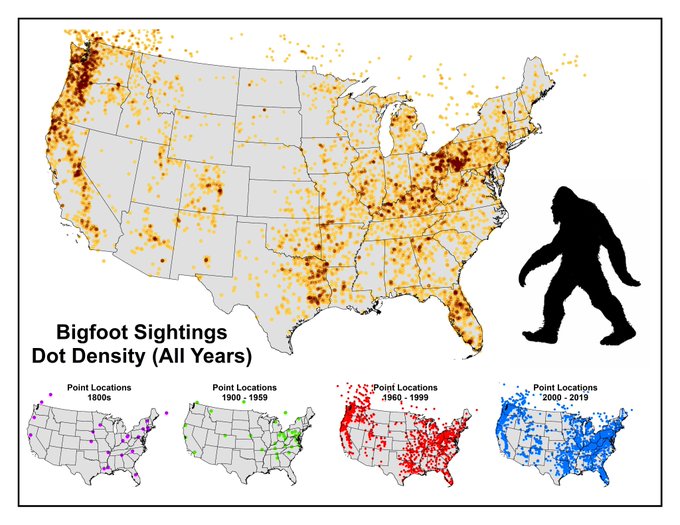
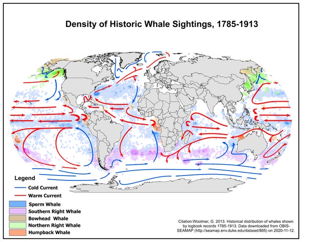
Map Gallery
A selection of cartographic and data visualization projects exploring environment, public health, infrastructure, and culture. These maps range from exploratory analysis to public-facing communication tools.


Story Maps and Dashboards
During my time at CARES I’ve put together a number storymaps and dashboards for a variety of audiences. Below are a selection of them. It should be noted that for many story maps, my coworkers wrote some or all of the text, but I put together the mapping components myself.

Using the Census LEHD OD dataset, I calculated out mean commuting distances for each census tract. I then built a random forest model to predict the mean commute distance using workplace area characteristics and commuter characteristcs. From this I built a visualization to identify census tracts where the actual commuting distance is signficantly different than what may be expected.
